


美波防災ナビ app for iPhone and iPad
Minami Disaster Prevention Navi is the official app of Minami, Tokushima Prefecture, a town dedicated to disaster prevention.
Functions
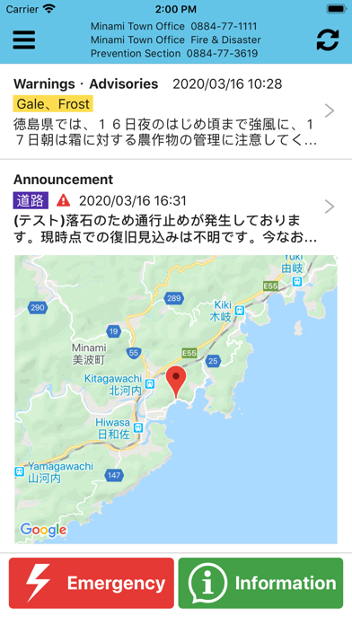
・ Notification and display of Japan Meteorological Agency warnings and alerts
The app displays warnings and alerts issued for Minami. It also delivers notifications when warnings and alerts are issued.
・ Notification and display of announcements
The app displays announcements related to disaster prevention from Minami, along with a map. It also delivers notifications when the announcements is issued.
・ Display of live camera images
The app shows images from live cameras installed around Minami.
(Live camera images are shown in a browser.)
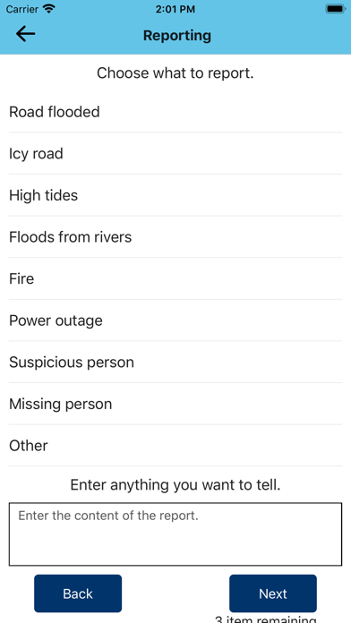
・ Disaster reporting
Users can report disaster site conditions to Minami, with photos and location information.
・ Display of disaster prevention information
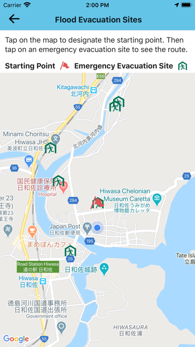
The app displays tsunami evacuation sites and maps, flood emergency sites, and a Hiwasagawa River flooding hazard map (with mudflow warning zones, etc.).
・ Evacuation route display
The app displays the route from the users current location to an evacuation site, to support evacuation in the event of a tsunami or flood. Users can also simulate evacuation by displaying the route from a specific point to an evacuation site.
(The route is displayed in a browser or in the Google Maps app.)
Caution:
・ The app may be downloaded and used free of charge, but requires fixed packet communications. Packet communication charges may be incurred, according to the app users communications provider contract.